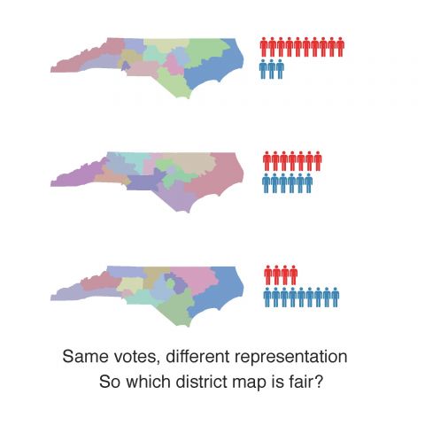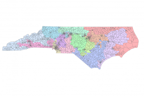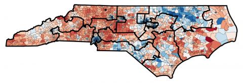
Martin Guo (MIDS), Dani Trejo (CS), James Wang (CS/Math), and Grayson York (Math/CS) spent ten weeks building tools to understand voting patterns and gerrymandering of districts in North Carolina. They used dimension reduction techniques to cluster different elections into common groups, and they tested various methods for generating synthetic elections for comparison.
View the team’s project poster here
Watch the team’s final project presentation on Zoom:
This project is part of an ongoing set of projects by the sponsoring faculty around Voting, Gerrymandering and Democracy. See their blog ( https://sites.duke.edu/quantifyinggerrymandering/) for more information and projects from previous years of Data+ and Bass Connections.
Project Leads: Greg Herschlag, Jonathan Mattingly