iiD Projects Projects
A team of students led by Hubbard Brook Experimental Forest researchers will develop a machine learning approach to identify aquatic insects and contribute to a long-term ecological dataset being used to examine changing insect population dynamics. Students will use a set of existing images to train a supervised machine learning...
A team of students led by researchers in the Energy Data Analytics Lab and the Sustainable Energy Transitions Initiative will develop a method to evaluate electricity access in developing countries through machine learning techniques applied to aerial imagery data. Students will first improve the accuracy of the solar array identifying...

A team of students led by staff from the Duke Office of Climate and Sustainability will explore improvements to Duke University’s greenhouse gas data system. Students will see how the data flows through campus and how it is ultimately used to quantify and report on Duke’s contribution to climate change...

A team of students, led by Nicholas School professor David Gill and Masters student Sameer Swarup, will develop the first global coastal social-environmental atlas: a high-resolution, interactive data platform that provides social, economic, demographic, and environmental data relevant to climate and ocean science and conservation. Students will synthesize spatial and...

A team of students, collaborating with Professors Mike Bergin, David Carlson, and PhD Candidate Zach Calhoun developed a modeling approach to estimate heat stress in urban areas. Students will further develop a dataset consisting of high-resolution temperature and relative humidity observations in over 60 cities (https://www.heat.gov/pages/mapping-campaigns), satellite imagery and meteorological...

A team of students led by Ph.D. student Yu Wei and assistant professor Tong Qiu from the Spatial Ecology and Environmental Data Sciences (SEEDS) lab will utilize cutting-edge remote sensing technologies—including hyperspectral imagery and airborne Light Detection and Ranging (LiDAR)—combined with an advanced deep learning framework to enhance forest biodiversity...
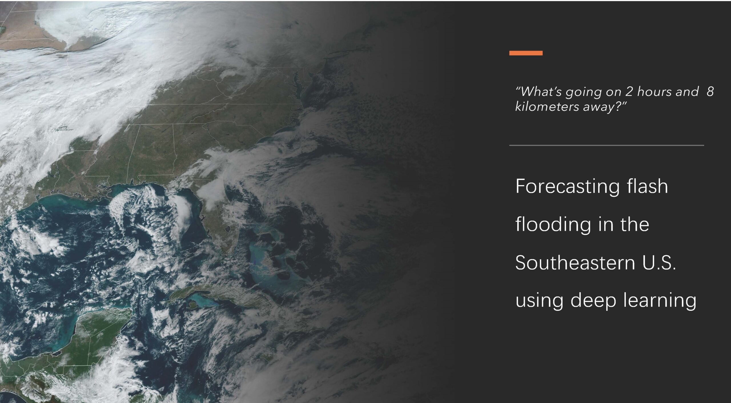
A group of students, guided by climate science and environmental engineering professors, will use deep learning models to enhance flash flood predictions in the Southeastern United States. They will study extreme weather events that contribute to flooding and learn to identify these events using satellite and radar imagery. By applying...

Students will create accessible, actionable data on climate risks and climate resilience efforts in the Milwaukee River area. By harnessing existing data sources as inputs for hazard modeling, focused on flooding, students will use techniques to account for uncertainties in inputs, providing more accurate and adaptable risk assessments for communities....
Showing all 8 results